Dive in: Boone’s best river spots
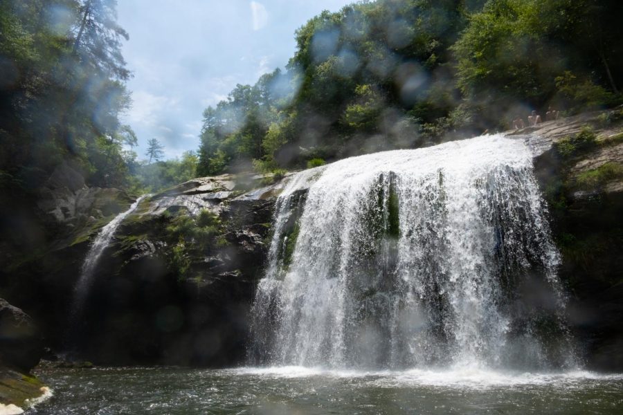
At the top of Compression Falls, swimmers prepare to jump off the commonly known jumping spot at the top, accessible by climbing up the right bank of the river when facing the waterfall, July 17, 2022.
August 15, 2022
There are many hidden hangouts along the Blue Ridge Parkway and multiple falls in neighboring counties that make for infinite adventures and memories. When venturing to new locations, always remember to take caution on rocks and to consider river depths before jumping in, and keep in mind that these spots are only a fraction of what Appalachia has to offer.
With those words of reckoning in mind, have fun and stay safe chasing these falls.
Winklers Creek
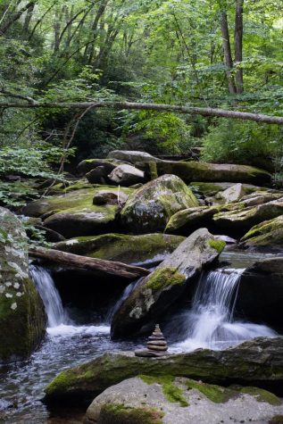
If you’re looking for a quick cool off then the Winklers Creek swimming hole is the perfect spot. Located a half mile down Winklers Creek Road, there are gravel spots on the right shoulder to park before hiking down to the spot. The trail begins on the left of Winklers Creek Road, and is a short hike to the swimming hole. Upon arrival, a garden of rocks are nestled at different angles with individual cascades and a large open swimming hole. There’s even a rope swing that makes for a fun water entry.
Trash Can Falls
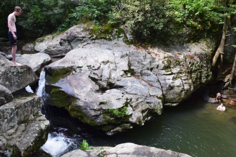
One of Boone’s most popular river destinations is Laurel Creek Falls, commonly referred to as Trash Can Falls. The falls are located roughly eight miles outside of Boone off of Highway 321 with a narrow hike to the falls. Trash Can Falls is the location to take it easy and bask in the sun alongside the stream, or for an adrenaline rush jumping into the water alongside the falls at heights ranging from 15 to 30 feet.
Snake Pit
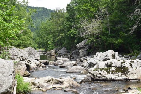
(Brionna Dallara)
Across the road from Trash Can Falls, river goers can venture down a knotted rope ladder to reach Snake Pit. While the intimidating name may lend itself to descending into a scene out of “Indiana Jones,” hikers are greeted with a large swimming hole and various spots to relax on.
To locate both Trash Can Falls and Snake Pit, follow Highway 421 toward Tennessee and make a left at the old Skate World roller skating rink. Visitors continue down this road over the Old Watauga Bridge before seeing areas to pull off on the left side of the road.
Compression Falls
Located 43 minutes from Boone near the Tennessee-North Carolina border, Compression Falls, also known as Twisting Falls, has multiple swimming holes to plunge into. There’s a steep three-quarter mile hike to get to the base of the falls that is considered challenging to inexperienced hikers. However, once the base of the falls is visible you can slide or jump into the water hole below or continue venturing upstream. Compression Falls features several waterfalls ranging from 10 to 20 feet tall, and is a remarkable sight for those looking for a grandiose fall and seeking a mountain escapade.
Gragg Prong / Hunt Fish Falls
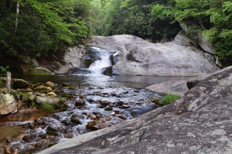
(Brionna Dallara)
Gragg Prong Falls offers multiple river spots and camping spots with endless routes to explore. Gragg Prong Falls is located 43 minutes from Boone off of Roseboro Road, a gravel road leading from Linville to the parking area where a bridge crosses over Gragg Prong Creek.
The multiple trailheads on arrival may be confusing. The correct trail following Gragg Prong downstream is indicated by a blue marker labeling the Lost Cove Trail, which runs alongside the Mountains to Sea Trail indicated by the white marker for a portion of the hike. Gragg Prong has an upper and lower falls, with an additional waterfall and swimming hole located about half a mile in. From the upper Gragg Prong Falls you can take an additional 45 minute trek to Hunt Fish Falls, which is home to another natural pool.








Mike Terrell • Aug 17, 2022 at 9:09 am
Does Elk Park Flass not qualify since the title includes “Boone’s Best”? Took many a jump in 1977 and 78 while at Lees-McRae and several more while attending APP. Just a question. 50-60 feet of chills, thrills and and for some, unfortunately, doctor bills.